
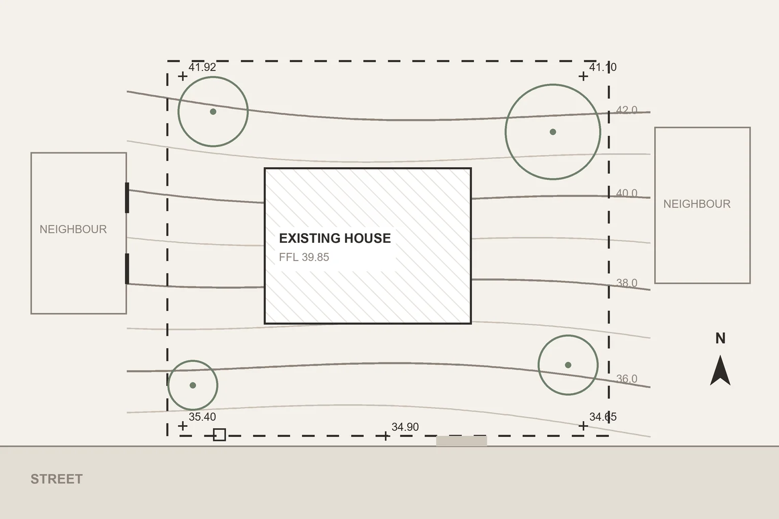
A feature and level survey is a measured plan of your block as it stands today: the contours and spot levels, the existing house, trees, services, fences and the neighbouring buildings. On a flat block it mostly confirms what you can see. On a sloping block it is the document every other decision starts from, so it belongs at the very beginning of design.
What a feature and level survey shows
A land surveyor visits the site and records its levels and features against a common datum. A typical survey shows:
- contour lines and spot levels across the block, including at the boundaries
- the existing house, its floor level and any retaining walls, steps or paving
- trees, with their height and canopy spread
- fences, pits, meters and visible services
- the kerb, crossover, footpath and street trees at the frontage
- neighbouring buildings, their walls near the boundary and their windows
The diagram at the top of this post is illustrative, but it shows the idea: the contours tell you which way the block falls and by how much. The spot levels at each corner put a number on it.
When do you need one?
Before design starts and certainly before any permit. If the house needs a planning permit, clause 54.01-1 of the planning scheme (55.01-1 for two or more dwellings) asks for a site description that accurately describes "levels of the site and the difference in levels between the site and surrounding properties". The same clause asks for the neighbours' habitable room windows within 9 metres, walls on the boundary, larger trees and any cut and filled areas where known.
If no planning permit is needed, the building permit still needs levels. Regulation 25 of the Building Regulations 2018 requires the allotment plan to show the levels of the allotment, the floors of the building, the street drainage channel and the stormwater drain, plus the drain layout to the legal point of discharge. A survey is where those levels come from.
Why the levels decide the design on a slope
Height limits are measured from natural ground level. In the General and Neighbourhood Residential Zones a house may go up to 1 metre above the height limit where the slope across any cross section of the building's site wider than 8 metres is greater than 2.5 degrees. The survey shows whether your block qualifies and where the tallest point of the house sits against the ground.
The levels also settle where the garage meets the street, how far the living floor sits above or below the garden and how much retaining the design needs. On Project Solstice the fall ran against the layout a standard floor plan assumes, so the light had to be designed into the plan rather than assumed.
Feature survey or re-establishment survey?
They answer different questions. A feature and level survey measures what is on the land. A re-establishment survey fixes where the title boundaries actually are. Under the Surveying Act 2004 only a licensed surveyor can do that cadastral work. Many feature surveys plot the boundaries from the title plan rather than re-establishing them. If you plan to build close to a boundary, ask your surveyor which you are getting.
Before you buy and before we design
You may not be able to survey a block before you buy it. If you can, a survey alongside a soil test before you buy replaces guesses about the fall with measured levels. Our director puts a feature and level survey on the short list of checks for anyone buying a sloping block, next to the soil report and the overlays and title restrictions.
On our sloping block builds the survey comes before the first sketch, because it is what tells us whether the block suits cut-and-fill, a split level or a raised floor. Our guide to building on a sloping block explains how each of those responds to the fall.
Frequently Asked Questions
What does a feature and level survey show?
The block as it stands, measured. A typical survey shows contours and spot levels across the site, the existing house and its floor level, trees with their spread, fences, paving, services and pits, the crossover and street features plus the neighbouring buildings with their windows. Boundaries are usually plotted from the title unless you ask for them to be re-established.
Do I need a feature and level survey for a building permit?
The building permit needs the levels a survey provides. Regulation 25 of the Building Regulations 2018 requires the allotment plan to show the levels of the allotment, the floors of the building, the street drainage channel and the stormwater drain. A planning application under clause 54 or 55 also has to describe the site's levels and how they differ from the neighbours'.
Who can do a feature and level survey?
A land surveyor. Only a licensed surveyor registered with the Surveyors Registration Board of Victoria can carry out cadastral work, which includes re-establishing boundaries, so ask whether the boundaries on your survey were re-established or plotted from the title.
How much does a feature and level survey cost?
The size of the block, how steep and treed it is, how much of the neighbouring properties the survey has to pick up and whether the boundaries need re-establishing all change the price. Ask surveyors to quote on the same brief so the quotes compare like with like.